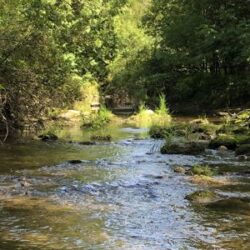
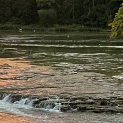
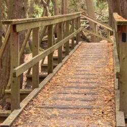
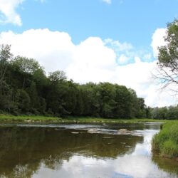
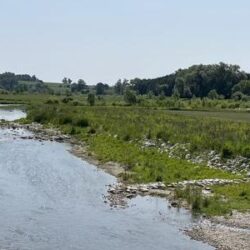
• Home
  • About Us
    • Introduction
    • Board of Directors
      • Board Meeting Agendas/Minutes
    • Maps/Documents/Publications
    • Employment Opportunities
    • Tenders / RFP’s
    • Staff Directory
    • Upcoming Events
  • Stewardship Programs
    • Education Programs
    • Tree Planting Programs
    • Water Quality Programs
    • Why Healthy Water?
    • Carbon Footprint Initiative
      • Carbon Footprint Initiative – Downloads
  • Camping
    • Falls Reserve CA
      • About Falls Reserve CA
      • Facilities
      • Activities
      • Reservations
      • Fishing
    • Wawanosh Park CA
  • Conservation Areas
    • coming soon
  • Water Management
    • Flood & Erosion Safety Services
    • Types of Flood Notices
    • Flood Notices
    • Low Water Bulletins
  • Regulations & Permits
    • Regulations Introduction
    • Shoreline Regulations
  • Foundation
    • Maitland Conservation Foundation
    • John Hindmarsh Environmental Trust Fund
  • Contact Us

Contact Us! 519-335-3557

Find us on Map
maitland@mvca.on.ca
Maitland Valley Conservation Authority Maitland Valley Conservation Authority Maitland Valley Conservation Authority Maitland Valley Conservation Authority
1093 Marietta Street, Box 127
Wroxeter, ON N0G 2X0
519-335-3557
  • Home
  • About Us
    • Introduction
    • Board of Directors
      • Board Meeting Agendas/Minutes
    • Maps/Documents/Publications
    • Employment Opportunities
    • Tenders / RFP’s
    • Staff Directory
    • Upcoming Events
  • Stewardship Programs
    • Education Programs
    • Tree Planting Programs
    • Water Quality Programs
    • Why Healthy Water?
    • Carbon Footprint Initiative
      • Carbon Footprint Initiative – Downloads
  • Camping
    • Falls Reserve CA
      • About Falls Reserve CA
      • Facilities
      • Activities
      • Reservations
      • Fishing
    • Wawanosh Park CA
  • Conservation Areas
    • coming soon
  • Water Management
    • Flood & Erosion Safety Services
    • Types of Flood Notices
    • Flood Notices
    • Low Water Bulletins
  • Regulations & Permits
    • Regulations Introduction
    • Shoreline Regulations
  • Foundation
    • Maitland Conservation Foundation
    • John Hindmarsh Environmental Trust Fund
  • Contact Us

About Falls Reserve Conservation Area

Set along the scenic Maitland River, just minutes from Goderich, Falls Reserve Conservation Area is a 230 acre natural outdoor playground. The Conservation Area offers terrific camping experiences: a perfect combination of great family camping in a beautiful natural setting.

Falls Reserve is nearly enclosed by the winding Maitland River. Over thousands of years the river has carved its way through rock, leaving behind a rugged river valley. Wide and shallow, the river cascades over a series of low waterfalls as it flows around the park creating a unique and exciting swimming area for visitors.

The steep slopes of the river valley, particularly from Auburn to Goderich, are well vegetated and provide important wildlife habitat. Some of the Easter White Cedar trees that cling to the exposed limestone cliffs are over 300 years old. This is probably the only old growth forest remaining in the Maitland watershed.

The lower Maitland River valley is also home to various plant species typically found in the more southern Carolinian zone. Some of these species include Butternut Hickory, Sycamore and Summer Grape. The area is also an important migratory bird route and a terrific spot for bird watching in spring and fall. Watch for Bald Eagles soaring over the Maitland River.

Falls Reserve Conservation Area is located at
80900 Falls Reserve Line in Benmiller.

Click here for Directions


Visit the Falls Reserve CA Facebook page

Camping

  • Falls Reserve Conservation Area
    • About Falls Reserve CA
    • Facilities
    • Activities
    • Reservations
    • Fishing
  • Wawanosh Park CA

Falls Reserve CA Downloads

  • Falls Reserve CA Fees & Information
  • Falls Reserve CA Campground Map
  • FRCA Regulations
  • Season Camping Payment Schedule & Refund Policy
  • Falls Reserve CA Guide

Working for a Healthy Environment

Recent Posts

  • Flood Outlook for Port Albert
  • Watershed Conditions Statement – Shoreline
  • Level of Lake Huron Expected to Continue Rising
  • Lake Levels and Shoreline Erosion Videos
  • Maitland River Field Survey – Wingham

Partner Links

Ausable Bayfield Maitland Valley
Source Protection Region

A Member of Conservation Ontario

Healthy Lake Huron

Carbon Footprints to Forests

Follow Us on Facebook

© 2019 · Maitland Valley Conservation Authority.

  • Home
  • Sitemap
  • Privacy Policy
  • Contact Us