Issued at: 7:00 a.m. Thursday August 4, 2022
Issued by: Maitland Conservation Flood Forecast Centre
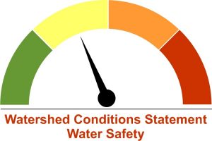
Watershed Conditions Statement – Water Safety
Severe thunderstorms that tracked through Southwestern Ontario yesterday evening brought significant rainfall to localized areas within the Maitland and Nine Mile River watersheds. As of 6:00 am this morning, 24-hour rainfall totals ranged from 30 to 125 mm, with heaviest amounts generally concentrated in a wide corridor extending from Goderich to Howick. The greatest intensity of rainfall was recorded in the Wingham area, where a total of 125 mm was received, 80 mm of which fell in less than 2 hours.
Significant flooding is not expected but river levels will rise throughout the day, especially along the Lower Maitland downstream of Wingham. Campgrounds and anyone participating in recreational activities within or near river lowlands are advised to use caution and be aware of the potential for fast changing conditions. People are encouraged to defer recreational activities on the river until next week.
Maitland Conservation staff will be closely monitoring the situation over the next 48 hours and will provide an update if conditions change. This message will remain in place until 4:00 pm on Monday August 8, 2022.
Contact:
Jeff Winzenried, Water Resources Technician
[email protected]
Media Contact:
Jayne Thompson, Communications Coordinator
[email protected]
519-335-3557 ext. 226 Cell: 519-357-6670
Types of Flood Messages:
Watershed Conditions Statement – Water Safety – General watershed conditions are being assessed for high runoff potential that could lead to flooding, and to remind the public of general river safety issues.
Watershed Conditions Statement – Flood Outlook – Early notice of the potential for flooding based on weather forecasts calling for heavy rain, snow melt, high wind or other conditions that could lead to high runoff, cause ice jams, lakeshore flooding or erosion.
Flood Watch – Flooding is possible in specific watercourses or municipalities. Municipalities, emergency services and individual landowners in flood-prone areas should prepare.
Flood Warning – Flooding is imminent or already occurring in specific watercourses or municipalities. Municipalities and individuals should take action to deal with flood conditions. This may include road closures and evacuations.